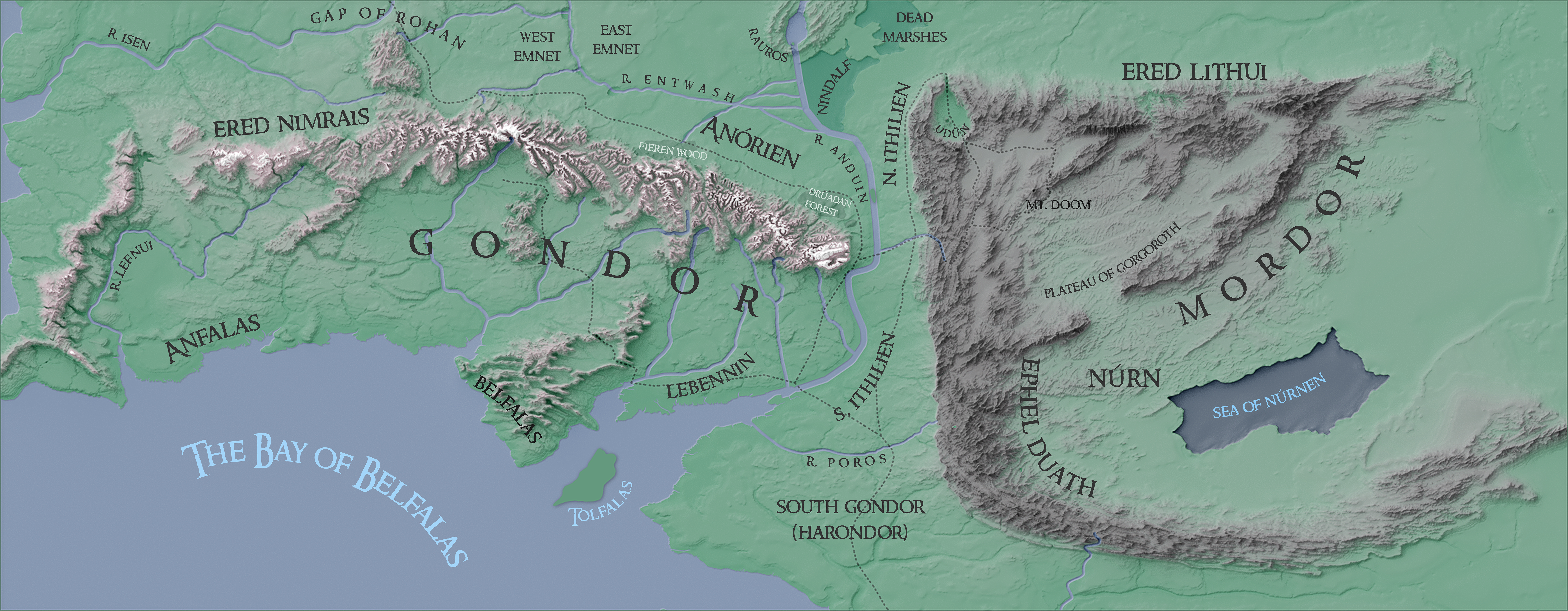
Robert Rose of William & Mary posted a very interesting analysis of an optimal route from the Shire to Mt. Doom. Thankfully, he also posted the data behind the analysis, which included some great 50m DEMs and feature classes.
I’m not going to go over the process in great detail, but it involved the following:
- Creating a fixed layout in Pro where I could export data from
- Creating a shaded relief in Blender, following Daniel Huffman’s method
- Blending it all together in Photoshop, again following Daniel Huffman’s method and drawing inspiration from his Photoshop terrain walk-through
- Labeling in Illustrator. Thanks to Pete Klassen for making the Ringbearer typeface free to use (for personal use).
I really wanted to include Barad-dûr (Sauron’s fave hangout), but it seemed strange to include something outside of natural features and political regions. Also, it would be interesting to see this with some bathymmetry data, but it sadly doesn’t exist in this dataset! There is another dataset that does include some contouring in the ocean, but its DEM is 200m and the two datasets sadly don’t line-up in any GIS software.